La Push, Washington & Olympic National Park
 |
| A totem pole in La Push |
|
I would wager there are few places on Earth where you can experience three distinctly separate ecosystems within a stone's throw of each other. Olympic National Park is one of those places with zones of coastal, mountains and rain forest terrain in close proximity to each other. When I arrived in La Push, Washington on the Washington peninsula it was blowing a literal gale. The sun had already set, so there was barely a hint of what the daylight might have in store. I could hear the roaring sound of waves crashing on the beach and it was louder than any waves I'd heard in the past. I would learn the next morning the waves were over 10 feet high and and further to the north I could see crashing waves that appeared to be nearly twice as high. Salt water spray was in my face the instant I walked outside and it wasn't long before it coated everything. Putting out my awnings wasn't an option with the wind blowing so hard, so I'd just leveled up the coach, deployed my slides and raised my satellite antennae to settle in for the night. I learned about La Push from my friends and next door neighbors, April and Peg, back at the Blue Sky RV park in the mountains above Seattle. They seem to have a good feel for RV parks and they would be joining me the next day. It's nice to make friends on the road. Friends make a positive difference in my travels and I try not to miss any opportunity to make new friends.
 |
| The sea mist made this scene look like a fog on the water. |
The first morning in La Push was dramatic. The wind was blowing an honest 30 mph with driving rain that made the motor home rock just enough to be noticeable. The flutter of my slide covers sounded like a flag in a hurricane. It's no wonder that so many slide covers tear and stretch. The worst case, though, is when someone leaves out their main patio awning and it gets destroyed in a strong wind. It's a couple of hundred to replace an awning cover, but it can be a couple of thousand to replace a main awning if you've got the expensive fabric. The scene in my windshield that first morning was awe inspiring with giant offshore swells crashing against huge offshore rocks causing plumes of salt spray to shoot high into the air to be carried on the wind. This wasn't like any other place I had ever seen.
 |
| Three sea stacks just outside the river mouth. The sand beach is covered with smooth rocks. The foam line should have told me how high up on the beach the waves would come. I found out this day that I can still run. Yes, I walked down closer to the water and got chased back by incoming surf. The pretty smooth rocks are slippery. | | |
Before coming to Olympic National Park I didn't know a sea stack from a hay stack. I have since learned that sea stacks are islands of rock near the shore that used to be peninsulas before erosion made them into islands. I don't know how many millennia it takes to form a sea stack, but I do know how they are formed. At one point in their development they are still attached to the shore by a narrow spit of land that eventually erodes into an arch. After additional erosion the arch collapses in on itself and that's how the sea stacks become islands. People who live in the northwest in coastal areas of Oregon and Washington are treated to these sights everyday, but to this traveler the view was nothing less than spectacular. Also ever present along the coast are shore birds, mostly seagulls. I've seen Herring Gulls, but there are also at least a few other species of gulls in the area. Bald eagles can also be seen in good numbers. In the mouth of the river I've counted six or more fishing and generally hanging around. They appear to be mated pairs. At dusk I found where the eagle's roost. It's behind the Coast Guard station in the pine trees. I'm thinking life as an eagle could be more than tolerable, all things considered.
 |
| Gulls at the mouth of the river looking for a handout. |
Less than a half mile from my RV park is the mouth of the Quileute River. This village is, in fact, the Quileute Indian Reservation, slash La Push township, slash Olympic National Park. The Quileute (pronounced quil-ee-ute) are a salmon fishing tribe limited to this specific area of Washington. The tribe appears to be poor and they wouldn't have anything if it weren't for their salmon fishing rights. They are, in fact, very protective of their salmon fishing rights and nobody outside the Quileute tribe is allowed to fish there. For the Quileute salmon fishing is an ancient tradition and their river is host to the most significant salmon run in the entire United States, outside Alaska. In a protected break water cove inside the town limits sits the Quileute marina and it's filled with fishing and crabbing boats.
 |
| Crab traps stacked on the river bank ready for action. Several bald eagles were seen in the trees of this sea stack. |
 |
| The marina was small, but picturesque. The Coast Guard station with the red roof is seen in the background. |
 |
| Smiling for the camera this Quileute fisherman is taking his catch of three coho salmon into the plant for processing. |
It wasn't salmon season, but I did see a few Quileute tribesman walking into the fish processing plant with pretty big Coho salmon. King salmon are their favored salmon species, but Coho and Steel Head are also targeted at different times of the year. I guess steelhead aren't really salmon, but rather sea run rainbow trout. Standing on the jetty I was able to watch some bald eagles fish and a few sea lions cruising the shallows during low tide. I don't know what sea lions eat. I've been told that two species of sea lions inhabit the area; Stellar sea lions and California sea lions. I'm not certain what kind I saw that day, but they were big. I'm told that California sea lions bark and that Stellar sea lions roar. I'd learn more about that later down in northern California.
 |
| Another view of the marina in La Push. |
 |
| You can barely see it, but there is a sea lion in the lower center left of the picture. I tried to time the shot to get him mostly out of the water, but the delay in my digital camera made it almost impossible. |
The most dramatic aspect of being in La Push was the driftwood. Unless you see it with your own eyes it's difficult to imagine the kind of driftwood I'm talking about. Whole trees were strewn and stacked along the beach in concentrations that make one wonder where they could have all come from and whether they were there to stay or move on with the next big storm. I asked some locals about the trees and I was told they drifted down from Alaska on a major current. I believed him. Someone else told me they came down the river from logging areas. I believed him, too. Maybe it's both, I don't know. Alaska sounds more plausible to me given the enormous size of the trees. But, why would there be such a concentration of these trees here? Turns out the phenomenon is common to other areas of the Pacific coastline, so we're talking millions of trees drifting along the coast for a very long time. I've got some great pics.
 |
| I have no idea why, but the dogs of La Push love to lie in the streets. Approaching traffic is not a deterrent to this behavior, either. They seem to have a survival instinct or confidence most other dogs don't have. I've pulled up with my bumper almost over them and they still won't move. Maybe they're really depressed and suicidal. I don't know. |
So, the coastal ecosystem and the natives who inhabit the area were my first taste of Olympic National Park.
I like spending more time than is considered normal for a tourist when visiting these kinds of places. Learning how the locals live lends a kind of depth to the experience that I really enjoy. In the case of the Quileute Indians their story was not an especially happy one. Two days into my visit a young teenaged boy committed suicide. It wasn't an uncommon event in La Push. All I could think was that growing up in such a a place as this was not easy. The Quileute tribe has a pretty high incidence of alcoholism, which shouldn't surprise anyone, but it also has a high degree of chronic depression. When combined it makes for an intolerable condition for a select few. The whole village turned out for the church held funeral. When I talked with locals about the suicide they were a little tight lipped and almost matter of fact about it. Mostly, I'd say their attitude was more a "who's next" kind of mindset. I asked a Quileute girl if this kind of thing happens often and she said, "it mostly happens when the wind is blowing a storm". I've heard it is the same up in Alaska with the indigenous Eskimo Indians there. A friend told me that many in the northwest take supplemental vitamin "D" to compensate for the lack of sunshine during the wet season and it's supposed to help with chronic depression. All I know is not a day has gone by in the last two months that I've not had to wear my new green slicker/raincoat for protection from either the rain or the cold.
 |
| I believe this is a traditional whaling dugout canoe of the Quileute tribe. |
 |
| Standing line sentinels at the edge of Neah Bay. |
 |
| The marina at Neah Bay. Some of these boats are whaling boats. |
 |
| Pic taken at the northwestern most point in the continental United States, Cape Flattery. |
 |
| The circles on my GPS display are electronic breadcrumbs left behind my Pathfinder to and from Cape Flattery. Like I said, you can't go any further to the north or west. Pretty cool. |
 |
| I'm drawn to north Pacific Indian art for its simplicity and artistic representations. Paintings and carvings always have a kind of primitive cave drawing quality about them. I really shouldn't be surprised given these tribal artists are what remains of the aboriginals who came across the Siberian land bridge before the last ice age or was it after? This image of a sperm whale exaggerates the teeth, but who's to say it's really an exaggeration when viewed from a dug-out being sunk by the whale's fluke. While none of us would condone whaling on even the smallest scale we have no choice but to respect ancient Indian traditions and make allowances for a culture trying to perpetuate its aboriginal roots. |
I visited all three of the Indian reservations while I was on the peninsula. They all have the same depressed and government dependent atmosphere about them. The other two are the Hoh of the central highlands and the Makah of the northern coast. The Makah are most interesting to me because of their retained right to hunt whales out of Neah Bay. I arrived in Neah Bay too late to visit the museum, but I was told about it. Archeologists are excited about this stretch of coastal plain because they've uncovered a Makah village buried under volcanic ash and it is perfectly preserved. They claim it's about 500 years old. The tribe has transferred all those artifacts to the new museum at Neah Bay.
Washingtonians are still up in arms over the whale hunting, of course, but what can anyone do? It's the Makah heritage and tradition. I was told they use traditional dugouts and spears and once the whale is hit they put it out of its misery quickly with a .50 caliber rifle. I won't stand in judgement over the Makah, but it is nonetheless sad that they are still killing whales for any reason. The Hoh tribe are more inland and they inhabit the rain forested areas of the peninsula and the adjacent mountains.
 |
| On the way to the Hoh Rain Forest I saw this bear in the roadside ditch. Today, it's a dog in the picture, but at 45 mph it was a 200 pound black bear in a cinnamon phase coat. In fact, I stopped and turned around to get a picture of the
bear I had just passed by. I felt pretty silly once I saw the tail wagging at me. At first glance he does look bear-ish, right? |
 |
| This pic was taken to illustrate how the forest changed in just a few miles. |
 |
| The bigger the trees got the darker the forest floor became. |
 |
| Deciduous trees have to carry the weight of this moss. It's everywhere. |
 |
| April and Peg heading out of the Hoh loop. We'd be eating together at La Push's only restaurant in a matter of hours. |
 |
| Elk crossing the road in Hoh Rain Forest. |
Visiting the Hoh Rain Forest was somewhat anticlimactic because what I saw was pretty much what I expected to see. There were no surprises. Large ferns are the primary ground cover along with other low light plants like lichens and mushrooms. Trees are covered in moss and evergreens dominate over deciduous trees. Small creeks are everywhere feeding into the river. What ever you can imagine growing in this micro climate is likely growing there. I'm told some islands in Hawaii get as much or even more rain. The Olympic rain forests get an average of 110 inches of rain a year. That's nearly 10 feet of rain. Translated that means a full 1/3 inch of rain must fall every 24 hours. That's a lot of rain, especially considering it didn't rain the day I was there and there must be other rain free days. The forest floor of the rain forest virtually defines the word lush and even on a sunny day not all that much light makes it past the canopy of towering trees. Everywhere you look water is on the move towards the valley floor and the river flowing through it. This really is a place that time has forgotten. It's gotten more and more difficult to find old growth trees in the northwest and they are few and far between here as well. That said, the biggest Sitka Spruce tree in the entire USA can be found in the Hoh Rain Forest and I've got a picture of it. It's just over 12 1/2 feet in diameter and stands 270 feet tall. I can only imagine what the Hoh Rain Forest looked like when every other tree was as big.


 |
| Romeo and I standing in front of the biggest Sitka Spruce in the country. |
 |
| View of the tree looking up the trunk. What's interesting to me is that really big trees do not have a lot of taper |
I didn't really venture into the mountains all that much because most of the time spent on the upper peninsula was in rain, but I did drive through the mountains on several occasions. Highway 101 is the road that encircles Olympic NP and it goes through the town of Port Angeles on the north coast. Just beyond to the west is Lake Crescent. The lake is magnificent and the color of the water, I'm told, can be attributed to "glacial dust". It's unique to my experience and quite beautiful.
 |
| There is beauty in this world that pictures can't do justice. Lake Crescent is one of those images. |
 |
| I'm particularly happy with this image. It has a lot of the basic elements of a good landscape picture; depth of field, perspective and composition are all spot on. The reflection of the light between the mountains was particularly fortunate or should I say lucky. The various shades of blue are a wonder of this mountain scene. |
Living in La Push for a week I got to know a few of the locals and as it turns out people are simply people no matter where you find them. I had dinner one night with the restaurant owner in La Push. Janet and I visited and as it turns out the tribal council is wanting to terminate her lease and take over the business. It's a shame because she feels as much a part of the community as any tribal member. And life goes on. When you cruise through La Push there are two street signs that are curious. They read, "Smoked Salmon" with an arrow pointing in a particular direction. That's how I found Pokee. Pokee is a Quileute woman about my age who smokes salmon for a living when they are in season. I bought 3 packs of fish and got one free. I figured I'd send the vacuum sealed smoked salmon to friends around the country. The problem is that I opened one pack and the fish was bone dry. It had a great flavor and it would make for a great fish dip, but I can't recommend eating it by itself. Pokee gave me lots of her business cards to hand out. Sorry, Pokee.
The town of Forks is about 15 miles from La Push and it's pretty typical of Olympic peninsula towns. Like all the other towns I saw Forks was just a cut above dirt poor. I honestly have no clue how those people sustain themselves, but there must be some underlying industry of some kind. I did see logging trucks on the highway.
 |
| Notice the arch. It's just a few millennia away from creating a new sea stack. |
Before leaving La Push for destinations south I made myself a promise that I'd hike to the "second beach" just out of town. It started easy enough and the trail was clear enough and wide enough to follow even in the dark. The hike was a mile and a half total, but I swear it was uphill in both directions or so my legs were telling me. The only real challenge was the last 300 yards before getting to the beach. The Park Service built earth and wood steps into the hillside to make the descent to the beach possible. However, once down on the sand I looked over my shoulder at what I had to scale to get back to the road and my car. It was daunting. I've never climbed the stairs of a 30 story building, but I figured this was the equivalent, but with uneven footing and the real possibility of taking a spill on the muddy sections. I didn't spend much time on the sandy beach, but I did manage a few pics before I turned my attention back to the climb before me.
The grade wasn't steep enough to justify a rope, but I would have used one if it had been installed. I must say I was pleasantly surprised by my stamina. I didn't get nearly as winded as I thought I might and while I did sweat some I was comfortable enough. I stopped only twice on the way up and passed on one opportunity to sit down on a makeshift bench to rest. In fact, I fared well enough that I will no longer avoid such hikes in the future. I felt comfortable hiking alone on the trail because there were others taking the same hike who could help if someone took a bad fall or had a heart attack.
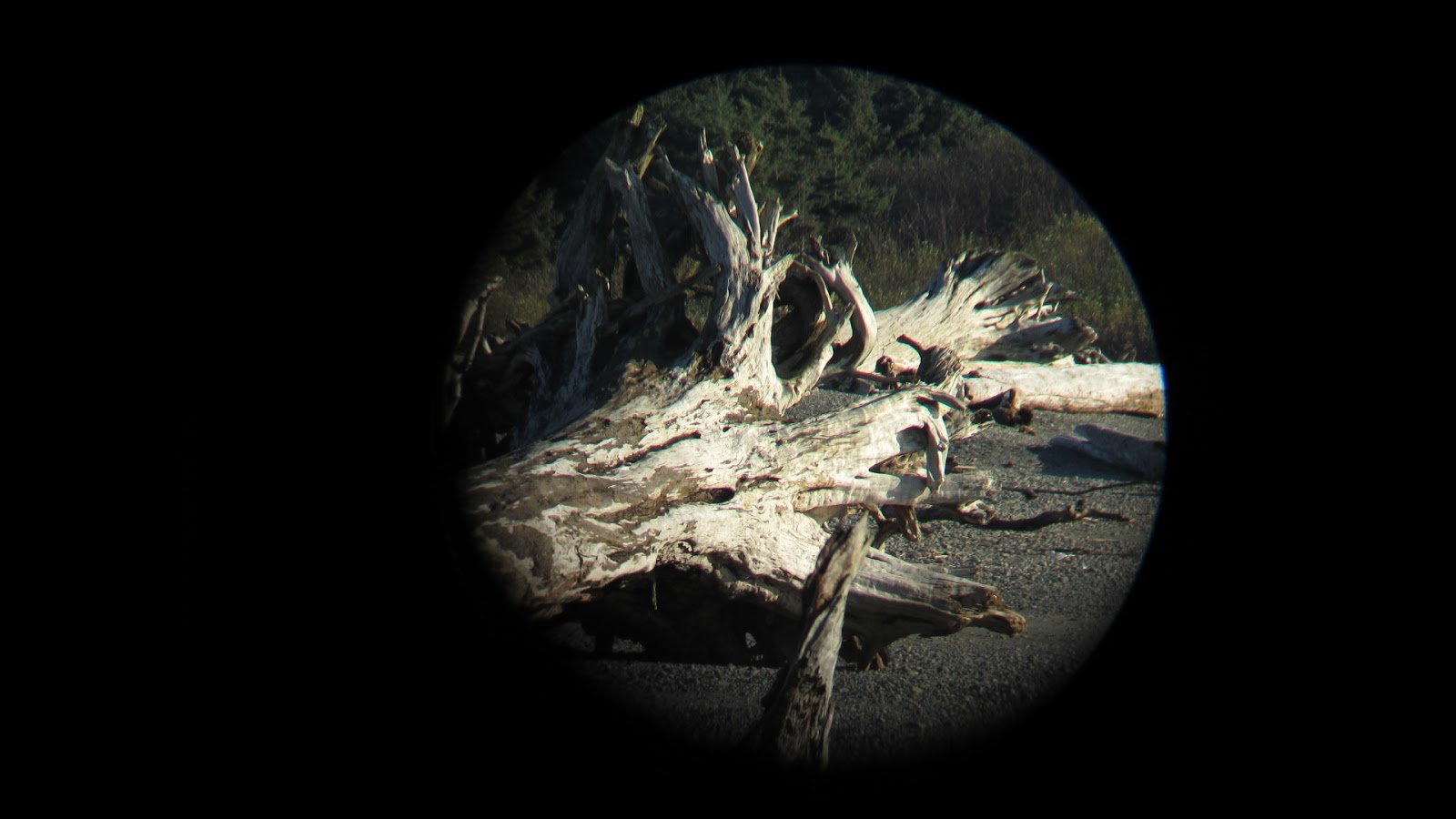
 |
| I took this series of pics using my spotting scope with a special adapter for my Canon digital camera. At 64x the speck on the water became a spire. I wonder how many years it takes to wear down a sea stack to this extent. |
 |
| Up close with a breaking wave. The exposure is still not correct. |
 |
| Driftwood snags taken at about 500 yards. Lots of detail. |
 |
| The spotting scope really does provide a unique format. |
 |
| More driftwood. |
 |
| Hiking trail to Beach #2. |
 |
| A little wet and slippery. |
 |
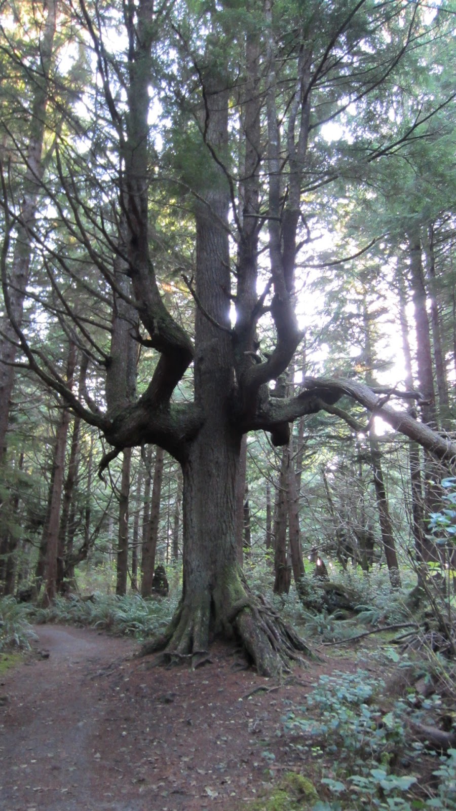
| An unusual looking tree on the trail of life. |
 |
| Going down the steps to the beach. Everywhere you look it's ferns, ferns and more ferns. |
 |
| Taken from the beach. Notice the arch. When it collapses the rock on the left will become a sea stack. |
 |
| All shapes and sizes of driftwood. |
 |
| Heading back up the steps to the first switch back. |
 |
| The hike really was fun and walking though the woods alone is a very peaceful thing to do. |
 |
| Looking back over my shoulder halfway up the "steps". |
 |
| Being on the West Coast brings to mind a simple thing. Here the sun sets occur over the water. Red skies at night, sailor's delight, right? I've shot a lot of sunsets in the last 11 months, but none more brilliant. |
 |
| I was told that some driftwood trees were so big that they sank into the sand never to be seen again. |
 |
| How big do the seas have to be to set a driftwood stump upright? |
 |
| Every rock in the sand was black and rubbed smooth. I did take one rock as a souvenier. It is white quartz w/speckles. |
 |
| Romeo's new place to ride in the wind and cold. |
 |
| A scene typical of the Olympic peninsula. |
 |
| Gulls are always looking for a free handout. |
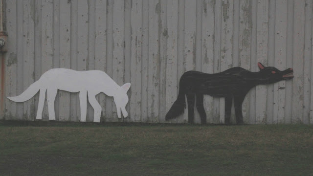 |
| More Quileute art on public display. |
 |
| Gnarly!! |
 |
| Home Sweet Home!! Leveled up with slides out and satellite dish focused on 3 satellites. |
 |
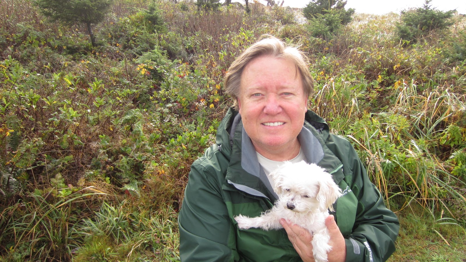
| Just happy to be alive! |
Leaving Olympic National Park went smoothly and with nothing but the open road in front of me I was excited about the day ahead. I was bound for Ridgefield, WA and a visit with a long time friend, Paul Rettinger and his son, Hank. I would attend a church service with Paul and recite the Lord's Prayer for the first time in a very long time. It hasn't changed.
mb/jd


No comments:
Post a Comment